A week in Montana is enough for one region, not the whole state. Montana covers about 147,000 square miles, and the drive from Missoula to Billings alone is about 345 miles. The three routes below each stay inside one part of the state, keep daily driving mostly under three hours, and start and end at an airport with year-round flights: Missoula or Glacier Park International for the north-west, Bozeman or Billings for Yellowstone, and Helena or Butte for the south-west.
Each route has a season, and in Montana the season decides the route more than anything else. Going-to-the-Sun Road in Glacier and the Beartooth Highway above Red Lodge are closed for roughly half the year, and many small museums and ghost towns in the south-west run only from Memorial Day to Labor Day. Distances below are road miles from a router, so treat them as "about" figures and add time for stops, road works and wildlife on the road.
The three routes at a glance
| Route | Start / end | Total driving | Best months | Built around |
|---|---|---|---|---|
| Glacier, Flathead Lake and Missoula | Missoula (MSO) or Kalispell (FCA) | About 500 mi | July to mid-September | Glacier National Park, Flathead Lake |
| Bozeman, Yellowstone north, Beartooth, Billings | Bozeman (BZN) to Billings (BIL), or a loop | About 500 mi | Mid-June to mid-September | Yellowstone, Beartooth Highway, Little Bighorn |
| South-west history loop | Helena (HLN) or Butte (BTM) | About 400 mi | Late May to early September | Butte, Virginia City, Bannack |
Route 1: Glacier, Flathead Lake and Missoula
This loop pairs three nights in Glacier with the lake country south of the park.
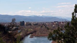
- Day 1, Missoula: fly into MSO. Walk the riverfront and visit the Smokejumper Visitor Center or the Historical Museum at Fort Missoula.
- Day 2, Bison Range and Flathead Lake: drive about 47 miles north to the CSKT Bison Range at Moiese and take the 19-mile Red Sleep and Prairie drive loop, then continue about 30 miles to Polson at the south end of Flathead Lake.
- Day 3, the lake to Whitefish: follow the lake north to Kalispell (about 55 miles) and on to Whitefish, 14 miles further. Bigfork and Wild Horse Island fit here if you take the east shore.
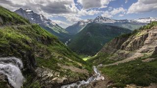
- Days 4 to 6, Glacier: follow our Glacier National Park in 3 days itinerary: the west side and Avalanche Lake, then Going-to-the-Sun Road east to Many Glacier, then a full day on the Grinnell Glacier trail. West Glacier is about 28 miles from Whitefish.
- Day 7, back: from the east side, return over the Sun Road to fly home from FCA, or drive about 220 miles (around 5 hours) south to Missoula on US-89 and MT-200.
Season: the full Sun Road has no fixed opening date. It opened on June 22 in 2026 and normally closes beyond its lower sections on the third Monday of October. The Bison Range's Red Sleep Drive runs only from about May to early November. For the high country, plan July to mid-September; in 2026 Logan Pass had 3-hour parking and a ticketed shuttle from July 1 to September 7, but no vehicle reservations.
Route 2: Bozeman, Yellowstone north, Beartooth and Billings
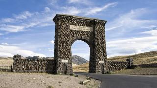
This route enters Yellowstone at its year-round North Entrance, leaves by the Beartooth Highway and finishes on the plains.
- Day 1, Bozeman: fly into BZN, Montana's busiest airport. Spend the afternoon at the Museum of the Rockies.
- Day 2, Paradise Valley to Gardiner: drive about 26 miles to Livingston, then south through Paradise Valley on US-89 to Gardiner, about 74 miles from Bozeman in all.
- Days 3 and 4, Yellowstone: follow our 2 days in Yellowstone from Gardiner itinerary: Mammoth Hot Springs on the first day, the Lamar Valley at dawn on the second. Sleep in Cooke City on the second night instead of returning; it is about 61 miles from Gardiner through the park.
- Day 5, Beartooth Highway: drive the 68-mile Beartooth Highway from the Northeast Entrance over Beartooth Pass, 10,947 feet (on the Wyoming side), down to Red Lodge.
- Day 6, Billings: Red Lodge to Billings is about 61 miles. See Pictograph Cave and the Rimrocks.
- Day 7, Little Bighorn: the battlefield is about 62 miles east of Billings. Fly home from BIL, or drive back to Bozeman (about 204 miles, three and a half hours).
Season: the Beartooth Highway usually opens on the Friday of Memorial Day weekend and closes in mid-October; in 2026 it opened May 23 and closed early on October 9. Snow can close it in June, so mid-June to mid-September is the safe window. Outside that, use the winter variant: Gardiner and the Lamar Valley stay open to cars all year, but the road ends at Cooke City.
Route 3: Helena, Butte, Virginia City and Bannack
Montana's capital, its copper city and two gold-rush towns, with no national park entry needed.
- Day 1, Helena: the free Montana Heritage Center, the State Capitol and Last Chance Gulch.
- Day 2, to Butte: about 68 miles on I-15. The World Museum of Mining and the Berkeley Pit viewing stand.
- Day 3, Anaconda: about 24 miles west for the 585-foot smelter stack at Anaconda Smoke Stack State Park and Lost Creek State Park. With a high-clearance vehicle, add Granite Ghost Town above Philipsburg.
- Day 4, Virginia City and Nevada City: about 90 miles from Butte. Walk the historic district, the territorial capital from 1865 to 1875, and ride the Alder Gulch Short Line to Nevada City.
- Day 5, to Bannack: about 83 miles via Dillon. Bannack, the first territorial capital, has more than 50 buildings; many can be entered.
- Day 6, Big Hole or Clark Canyon: Big Hole National Battlefield west of Dillon, or Camp Fortunate to the south.
- Day 7, back to Helena: about 131 miles from Dillon on I-15.
Season: Bannack opens all year, but Virginia City's railroad and Nevada City open only from Memorial Day weekend to Labor Day, and Granite Ghost Town from Memorial Day to September 30. For opening hours site by site, see our museums and historic sites guide.
Which route for which month
| Month | Route 1 (Glacier) | Route 2 (Yellowstone/Beartooth) | Route 3 (South-west) |
|---|---|---|---|
| May | Sun Road closed at the top | Beartooth opens late May | Most sites opening |
| June | Sun Road usually opens late June | Good after mid-June | Good |
| July–August | Best | Best | Best; smoke possible |
| September | Good; Logan Pass controls end after Labor Day | Good | Labor Day closes Virginia City attractions |
| October | Sun Road closes mid-month | Beartooth closes mid-month | Many sites closed |
| November–April | Lower west side only | Winter variant via Gardiner | Bannack, Helena and Butte only |
Joining routes together
With ten days or more, Routes 2 and 3 join well: Ennis is about 53 miles from Bozeman and 14 from Virginia City, so you can drive Route 3 south and east into Route 2. Routes 1 and 3 connect through Missoula and Philipsburg (about 77 miles). Joining Route 1 to Route 2 costs a full day: Missoula to Bozeman is about 204 miles on I-90.
Before you go
- Book rooms in West Glacier, Gardiner and Cooke City first; they are small and fill early.
- Check the NPS road pages for Going-to-the-Sun Road and 511mt.net for the Beartooth on the morning you drive.
- Non-US visitors aged 16 and over pay an extra $100 per person at Glacier and Yellowstone in 2026 unless they hold the $250 nonresident annual pass.
- Fill up before the Beartooth Highway and Going-to-the-Sun Road; fuel along both is sparse or absent.
- Read our scenic drives guide for road lengths and vehicle limits.
Details checked October 2026.