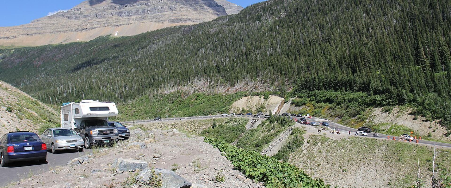
Montana's best-known drives fall into two groups. The high passes, Going-to-the-Sun Road in Glacier National Park and the Beartooth Highway above Red Lodge, open only from roughly late May or June to mid-October, and their dates decide many summer itineraries. The valley and forest routes, such as the Pintler Scenic Route, Paradise Valley, Kings Hill and the Seeley-Swan, are open all year and are often at their best in September and October, when the larches turn and the crowds thin out.
This guide gives the length, season and key stops for seven drives, with distances from official road logs where they exist and "about" where they come from a router. One route on most Montana lists, the Chief Joseph Scenic Byway, is entirely in Wyoming, and it is labelled that way here.
The seven drives at a glance
| Drive | Road | Length | Season | Start / end |
|---|---|---|---|---|
| Going-to-the-Sun Road | Park road, Glacier NP | About 50 mi | Full road usually late June to the third Monday of October | West Glacier – St. Mary |
| Beartooth Highway | US-212 (MT and WY) | 68 mi | Usually Memorial Day weekend to mid-October | Red Lodge – Cooke City / NE entrance |
| Chief Joseph Scenic Byway | WYO 296 (Wyoming only) | About 46 mi | Best June to October; check WYDOT in winter | US-212 near Cooke City – WYO 120 near Cody |
| Pintler Scenic Route | MT-1 | About 64 mi | Year-round | Anaconda – Philipsburg – Drummond |
| Paradise Valley | US-89 | About 54 mi | Year-round | Livingston – Gardiner |
| Kings Hill Scenic Byway | US-89 | 71 mi | Year-round | US-12 near White Sulphur Springs – US-87 near Belt |
| Seeley-Swan | MT-83 | About 91 mi | Year-round | Clearwater Junction – near Bigfork |
Going-to-the-Sun Road (Glacier National Park)
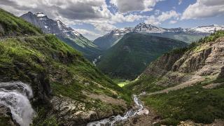
The only road across Glacier runs about 50 miles from US-2 at West Glacier to US-89 at St. Mary, crossing the Continental Divide at Logan Pass, 6,646 feet. It was finished in 1932, dedicated on July 15, 1933, and is a National Historic Landmark.
- Season: there is no fixed opening date. Plowing takes about ten weeks each spring, and the full road opened on June 22 in 2026. It normally closes beyond the lower sections on the third Monday of October (October 19 in 2026), and a storm closed the alpine section on the evening of October 9. In winter only the stretch from West Glacier to Lake McDonald Lodge is plowed.
- 2026 rules: no vehicle reservations were needed anywhere in the park. Logan Pass parking was limited to 3 hours from July 1 to September 7, with a ticketed shuttle to the pass on Recreation.gov over the same dates.
- Size limits: vehicles longer than 21 feet or wider than 8 feet (mirrors included) may not drive between Avalanche Creek and Rising Sun.
- Stops: Lake McDonald, Trail of the Cedars, the Loop, Logan Pass and the Hidden Lake Overlook, and Wild Goose Island on Saint Mary Lake.
Allow about two hours without stops and a full day with them. Glacier charges a standard entrance fee, and from 2026 non-US residents aged 16 and over also pay a $100 nonresident fee.
Beartooth Highway (US-212)
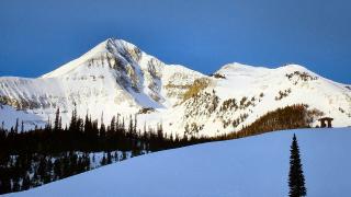
The 68-mile Beartooth Highway runs from Red Lodge over the Beartooth Plateau to Cooke City and Yellowstone's Northeast Entrance. It is an All-American Road and opened in 1936.
- The high point is in Wyoming. Beartooth Pass, 10,947 feet, lies on the Wyoming side; the road crosses the state line more than once.
- Season: usually from the Friday of Memorial Day weekend to mid-October. In 2026 the full road was open from May 23 and closed early, at 2:30 p.m. on October 9, ahead of a snowstorm. Expect it to stay shut until late May 2027.
- Practical: allow at least two hours one way, fill up in Red Lodge, and carry warm layers; summer snowstorms happen at the top.
Chief Joseph Scenic Byway (WYO 296, Wyoming)
Montana travel lists often include this road because it links with the Beartooth Highway, but it is a Wyoming state highway for its whole length. WYO 296 leaves US-212 about 13 miles southeast of Cooke City and runs about 46 miles through Sunlight Basin and over Dead Indian Pass, 8,071 feet, to WYO 120 about 17 miles north of Cody.
- Loop idea: Red Lodge – Beartooth Highway – Chief Joseph Byway – Cody – back north to Montana, a long day or an easy two.
- Season: the Beartooth end is closed in winter, so the loop works only while US-212 is open. The byway itself is plowed as needed in winter, but storms can close it; check WYDOT's 511 service before going.
Pintler Scenic Route (MT-1)
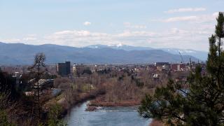
MT-1 leaves I-90 near Anaconda and rejoins it at Drummond after about 64 miles (63.7 in MDT's road log), passing the 585-foot Anaconda smelter stack, Georgetown Lake and the mining town of Philipsburg.
- Season: year-round, and the road to Discovery Ski Area in winter.
- Side trips: the Granite Ghost Town above Philipsburg (a rough gravel road; check conditions) and the Anaconda-Pintler Wilderness trailheads.
- Practical: combine it with I-90 for a loop from Butte or Missoula. Philipsburg is about 58 road-miles from Butte's airport.
Paradise Valley (US-89)
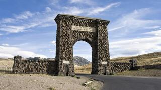
US-89 runs south from Livingston along the Yellowstone River, between the Absaroka Range to the east and the Gallatin Range to the west, to Gardiner and the Roosevelt Arch at Yellowstone's North Entrance. The drive is about 54 miles and takes about an hour.
- Season: year-round. The North Entrance is the only Yellowstone entrance open to cars all year, so this is the winter route into the park.
- Stops: Livingston's Yellowstone Gateway Museum, fishing access sites on the Yellowstone River, and Yankee Jim Canyon near the southern end. The valley is winter range for elk.
- Alternative: East River Road runs along the other bank for part of the valley and is quieter.
Kings Hill Scenic Byway (US-89)
This 71-mile section of US-89 runs north from the US-12 junction near White Sulphur Springs, through the Lewis and Clark National Forest and the Little Belt Mountains, to US-87 near Belt.
- High point: Kings Hill Pass, about 7,390 feet. Crews keep it open through the winter.
- Stops: Showdown ski area at the pass, the old mining towns of Neihart and Monarch, and Sluice Boxes State Park near the northern end.
- Practical: the northern end is a short drive from Great Falls, so the byway pairs well with a Great Falls stay.
Seeley-Swan (MT-83)
MT-83 runs about 91 miles from MT-200 at Clearwater Junction, about 40 miles east of Missoula, to MT-35 just north of Bigfork. It follows the Clearwater and Swan valleys between the Mission Mountains and the Swan Range.
- Lakes along the road: Salmon Lake, Seeley Lake, Lake Inez, Lake Alva and Swan Lake.
- Season: year-round. The western larches turn gold in October.
- Practical: return via Flathead Lake (MT-35 or US-93) to make a loop from Missoula. Services are sparse between Seeley Lake and Swan Lake.
Before you go
- Check 511mt.net or dial 511 for Montana roads; use WYDOT's 511 for the Wyoming sections.
- For Going-to-the-Sun Road, check the NPS road status page the same morning, and know the 21-foot length limit.
- Watch the clock in October: the Beartooth and the alpine section of Going-to-the-Sun can close with a few hours' notice.
- Fill up before Beartooth, Seeley-Swan and Kings Hill; fuel is sparse.
- Pack layers. Logan Pass and Beartooth Pass can be near freezing in July.
Details checked October 2026.