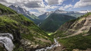

Three days in Glacier National Park is enough to see its three classic faces: the cedar forest and long lake on the west side, the alpine crossing of the Continental Divide on Going-to-the-Sun Road, and the glacier-carved valley of Many Glacier on the east. This route does them in that order: one night on the west side, two nights on the east, so the biggest hike of the trip does not end with a three-hour drive back.
It is written for the summer season, roughly July to mid-September, when the whole road is normally open and the high trails have melted out. Expect about 130 miles of driving inside and around the park and 15 to 20 miles on foot if you do every hike. The road is not a loop: once you cross to the east side, the way back west is either over the pass again or about 85 to 105 miles around the park's southern edge on US-2. Rules and prices below are the 2026 ones; Glacier had not announced its 2027 transport rules when this was checked in October 2026.
Before you go
- Entrance pass. $35 per private vehicle from May 1 to October 31, valid seven days. Since January 2026, non-US residents aged 16 and over pay an extra $100 each unless the car enters on an annual pass; the $250 America the Beautiful nonresident pass covers a whole car and pays for itself at once for two or more foreign adults. The park is cashless. Details: Montana park passes and permits.
- No vehicle reservations in 2026. For the first time in five years Glacier dropped its vehicle reservation system for 2026. Instead there was a three-hour parking limit at Logan Pass and a ticketed shuttle from July 1 to September 7. Check nps.gov/glac in spring for the 2027 rules.
- Shuttle tickets (if the system returns). In 2026 tickets were sold only on Recreation.gov, 60 days ahead from 8 a.m. Mountain time, with the rest released at 7 p.m. the evening before. The only charge was a $1 processing fee.
- Lodging inside the park. In 2026 Many Glacier Hotel opened June 5 to September 21 and Swiftcurrent Motor Inn June 8 to September 16; the 2027 dates are already published (June 3 to September 20 and June 8 to September 17). Reservations open 13 months ahead, on the 1st of each month at midnight Mountain time; book then and keep checking for cancellations.
- Bear spray and a card. You cannot fly with bear spray, so buy it in Kalispell, Whitefish, West Glacier or St. Mary. There is no fuel inside the park: fill up in West Glacier, St. Mary or Babb.
- Offline everything. There is no phone signal at Logan Pass or in Many Glacier. Download maps, save tickets and note your lodging confirmation before you lose coverage.
Day 1, morning — Lake McDonald and Apgar
Start at Apgar Village, a mile inside the west entrance at the foot of Lake McDonald. The lake is the park's largest, about 10 miles long, and its shore at Apgar is the classic place to see the coloured stones under clear water and the peaks around the head of the lake. Early morning is calmest; the water often turns to glass before the wind gets up.
The Apgar Visitor Center, open daily from mid-May to mid-October, has current trail and road reports and one of only two public Wi-Fi spots in the park. Eddie's Mercantile in Apgar sells supplies for a picnic lunch.
 Sunrise on Lake McDonald, the park's largest lake. Image: GlacierNPS, Public domain, via Wikimedia Commons.
From Apgar, Going-to-the-Sun Road runs along the lake's eastern shore. Stop at the pullouts rather than on the road, and allow time at Lake McDonald Lodge, the 1914 Swiss-chalet hotel near the head of the lake, where the lobby is open to visitors.
Day 1, midday — Trail of the Cedars and Avalanche Lake
About 16 miles from the west entrance is Avalanche Creek, the start of two of the park's most-walked trails. The Trail of the Cedars is a 0.9-mile boardwalk loop through western red cedar and hemlock, wheelchair accessible, with a footbridge over Avalanche Gorge, where the creek has cut a narrow, deep slot in red rock.
 The boardwalk on the Trail of the Cedars. Image: GlacierNPS, Public domain, via Wikimedia Commons.
From the far side of the loop, the trail to Avalanche Lake climbs about 500 feet through the forest. The round trip is roughly 5 miles; the park suggests three to six hours with time at the lake, which sits in a cirque with several waterfalls pouring off the cliffs at its head.
 Avalanche Lake, with waterfalls dropping from the cirque wall. Image: NPS Photo / David Restivo, Public domain, via Wikimedia Commons.
Parking here is limited and fills early, and in 2026 the shuttle did not stop at Avalanche, so you need your own car. Arrive before 9 a.m. or after about 4 p.m. If the lot is full, carry on and come back; do not park on the road shoulder.
If it rains: the cedar loop works in any weather. Skip the lake if the trail is closed for bear activity, which happens; check the park's trail status page.
Day 1, evening — back to the west side
Spend the night in Apgar, West Glacier or Columbia Falls, about 17 miles from the entrance. The red 1930s touring buses of the Red Bus Tours run evening and day trips over the road; in 2026 west-side tours left from the West Side parking lot in West Glacier, not from Apgar, and adult fares ranged from $64 to $138.
 One of the restored 1930s "jammer" buses that still run tours. Image: Don DeBold from San Jose, CA, USA, CC BY 2.0, via Wikimedia Commons.
Day 2, early — Going-to-the-Sun Road to Logan Pass
Today you cross the park on Going-to-the-Sun Road, about 50 miles from West Glacier to St. Mary. Without stops it takes around two hours; with stops it fills the day. From the west entrance it is 32 miles to Logan Pass, at 6,646 feet on the Continental Divide, climbing along the Garden Wall past the hairpin at the Loop and the Weeping Wall, where water runs down the rock onto the road.
Vehicles over 21 feet long or 8 feet wide are not allowed between Avalanche Creek and Rising Sun, and anything over 10 feet tall may struggle under the overhangs near the Loop. The speed limit in the alpine section is 25 mph. Cyclists had restricted hours in 2026: no eastbound riding from noon to 6 p.m. and no westbound riding from 3 to 6 p.m.
The Logan Pass lot has 235 spaces and, according to the park, "often fills before dawn and remains mostly full all day". In 2026 private cars could stay three hours, with a free timed permit from a kiosk. Turnover was quick, about 100 cars an hour at peak, so a space usually comes free if you are patient, but the best plan is still to leave West Glacier by 6 a.m. If the shuttle runs again, it is the stress-free alternative: in 2026 the first west-side buses left Apgar at 6 a.m., and the last left Logan Pass at 7:30 p.m. westbound and 8 p.m. eastbound, with no fallback if you missed them.
From behind the Logan Pass Visitor Center, the Hidden Lake Overlook trail climbs about 600 feet in 1.3 miles, much of it on boardwalk, across alpine meadows to a viewpoint over Hidden Lake and Bearhat Mountain. Mountain goats and bighorn sheep are common near the trail; keep at least 25 yards from them, and 100 yards from any bear. The section beyond the overlook, down to the lakeshore, is often closed for bear activity.
 A mountain goat at Hidden Lake, a common sight along the trail. Image: Robert M. Russell, CC BY-SA 4.0, via Wikimedia Commons.
Allow two hours for the overlook. With the three-hour parking limit, the longer Highline Trail is meant for shuttle riders; it opened for the 2026 season on July 7. Logan Pass sells no food or water.
Day 2, afternoon — Jackson Glacier, the falls and Wild Goose Island
East of the pass the road drops past the Jackson Glacier Overlook, one of the few places you can see a glacier from your car. By the park's count, about 150 glaciers larger than 25 acres existed in the mid-1800s and 25 active ones remained by 2010; Jackson is shrinking along with the rest.
 Jackson Glacier, seen from the overlook on the road's east side. Image: GlacierNPS, Public domain, via Wikimedia Commons.
Further down, the St. Mary Falls trailhead has its own parking lot. From there it is 1.2 miles to St. Mary Falls, a two-tier fall with deep blue-green pools, and another 0.6 miles to Virginia Falls, taller and set in the forest. The round trip to both is about 3.6 miles with modest climbs on the way back. There was no shuttle stop here in 2026.
 St. Mary Falls, 1.2 miles from the trailhead. Image: GlacierNPS, Public domain, via Wikimedia Commons.
 Virginia Falls, a short walk beyond St. Mary Falls. Image: GlacierNPS, Public domain, via Wikimedia Commons.
A few miles on, the Wild Goose Island turnout looks down Saint Mary Lake to the tiny island that appears in many of the park's best-known photographs. Late-afternoon light is often best. The road leaves the park at St. Mary, 18 miles from Logan Pass.
Day 2, evening — to Many Glacier
From St. Mary it is 21 miles north on US-89 through Babb, then west into the Many Glacier valley, about 35 to 45 minutes. Spend tonight and tomorrow night at Many Glacier Hotel or Swiftcurrent Motor Inn, both inside the park on Swiftcurrent Lake; St. Mary is the fallback if they are full. The Swiftcurrent and Many Glacier road work that limited access in 2025 is finished, and the trailhead parking now has 339 spaces.
 Sunrise over Swiftcurrent Lake, seen from Many Glacier Hotel. Image: GlacierNPS, Public domain, via Wikimedia Commons.
Day 3 — Many Glacier: Grinnell Glacier or Iceberg Lake
Many Glacier is the park's best area for long day hikes and for wildlife, with grizzly and black bears, moose and bighorn sheep regularly seen from the trails and the road. Pick one of two big hikes.
Grinnell Glacier is the classic. From the trailhead it is 5 miles one way with about 2,600 feet of climbing, past Swiftcurrent Lake and Lake Josephine to a viewpoint over Upper Grinnell Lake and the glacier. The boats of Glacier Park Boat Company shorten it: they cross Swiftcurrent Lake and Lake Josephine, with a short walk between the two, and cut the hike to 3.7 miles one way. In 2026 the Many Glacier boats ran from June 10 to September 19, the adult round trip was $41.70, and the company is selling 2027 seats at the same price, although the 2027 timetable was not yet published. The boats no longer offer guided hikes; the trail is self-guided. The upper part of the trail usually opens around mid-July, after the snow clears. A grizzly injured a hiker on this trail on May 28, 2026, and the trail closes when bears are active, so check the status the day before.
 Grinnell Glacier and Upper Grinnell Lake from the end of the trail. Image: Alexander Bock, CC BY-SA 4.0, via Wikimedia Commons.
Iceberg Lake starts behind the Swiftcurrent Motor Inn and runs 4.8 miles one way to a lake under a ring of cliffs, where ice often floats into August. The park's current figures are about 1,765 feet of climbing and 624 feet of descent on the way up. The trail shares its first miles with the route to the Ptarmigan Tunnel, whose doors are usually open from mid-July to late September.
 Iceberg Lake, with ice floating below the cirque walls. Image: Mountain walrus, CC BY-SA 3.0, via Wikimedia Commons.
For an easier day, the 2.3-mile loop around Swiftcurrent Lake is flat, and its first quarter-mile is wheelchair accessible.
Day 4, leaving: from Many Glacier it is about 105 miles back to West Glacier on US-2, roughly two and a half hours, or about three hours over Going-to-the-Sun Road again in summer traffic. Glacier Park International Airport is near Kalispell.
The days at a glance
| Day | Stop | Allow | Book ahead? |
|---|---|---|---|
| 1 | Apgar Village and Lake McDonald | 2 h | No |
| 1 | Trail of the Cedars and Avalanche Lake | 3–6 h | No; arrive early to park |
| 2 | Drive to Logan Pass | 1–1.5 h | Shuttle ticket if the system runs |
| 2 | Hidden Lake Overlook | 2 h | No (3-hour parking limit in 2026) |
| 2 | Jackson Glacier Overlook, St. Mary and Virginia Falls | 3 h | No |
| 2 | Wild Goose Island turnout, then Many Glacier | 1.5 h | Lodging, months ahead |
| 3 | Grinnell Glacier (or Iceberg Lake) | 6–8 h | Boat, if used |
Practical notes
- When. Going-to-the-Sun Road opened fully on June 22 in 2026, June 16 in 2025 and June 22 in 2024, but as late as July 13 in 2022. It normally closes on the third Monday of October. The high trails, including the Highline and upper Grinnell, often open only in July. For this itinerary, mid-July to early September is the safest window.
- Smoke. August is the usual smoke month, from fires in Montana, Idaho or Canada. In 2026 there was no fire inside the park, but smoke alerts came in early September. Check fire.airnow.gov before long hikes.
- Bears. Carry bear spray where you can reach it, hike in groups and make noise. Keep food in your car or a locker. More in health and safety in Montana.
- Food. Camp stores at Apgar, Lake McDonald, Rising Sun and Swiftcurrent sell basics in season, and the lodges have restaurants. Logan Pass has nothing.
- Phones. Expect no signal at Logan Pass, Many Glacier or along most of US-2 beside the park. Public Wi-Fi is available at the Apgar and St. Mary visitor centers.
- By train. Amtrak's Empire Builder stops at West Glacier all year and at East Glacier Park in summer, which makes a car-free arrival possible, but there are few rental cars at the stations.
Prices and rules are as published for the 2026 season and were checked in October 2026; Glacier usually announces its summer transport plan in spring.


