Montana is two states in one. About 60% of it is prairie, the northern edge of the Great Plains, while the western part is crowded with mountain ranges, a hundred or more of them by most counts. The Continental Divide runs between the two, so rain on one side of a ridge reaches the Pacific and rain on the other ends up in the Gulf of Mexico or Hudson Bay.
This guide goes through the landforms and the deep-time events behind them, from the ice-age floods that drained through Missoula to the dinosaur beds of the eastern badlands, and for each one says where you can see it. At 147,040 square miles, Montana is the fourth-largest state, so plan on long drives between the sites.
Montana in numbers
| Feature | Figure | Where to see it |
|---|---|---|
| Area | 147,040 sq mi, 4th-largest state | Everywhere, by car |
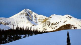
| Highest point | Granite Peak, 12,807 ft | Absaroka-Beartooth Wilderness, about 30 mi south-west of Red Lodge |
| Lowest point | Kootenai River at the Idaho line, 1,804 ft | Northwest corner, downstream of Troy |
| Mean elevation | About 3,400 ft | - |
| Geographic centre | Fergus County, about 11 mi west of Lewistown | Central Montana |
| Share of Yellowstone in Montana | About 3% | Gardiner, West Yellowstone, Cooke City |
The Continental Divide and Triple Divide Peak
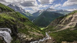
The Divide enters Montana from Canada inside Glacier National Park, runs south along the Rocky Mountain Front and loops west around Butte, where every road out of town except westbound I-90 crosses it. You drive over it at Logan Pass (6,646 ft) on Going-to-the-Sun Road, and the 90-foot Our Lady of the Rockies statue stands on it above Butte.
In Glacier the Divide meets a second one. From Triple Divide Peak (about 8,020 ft) water drains three ways: to the Columbia and the Pacific, to the Missouri, Mississippi and Gulf of Mexico, and north through the Saskatchewan River system to Hudson Bay. The St. Mary, Belly and Waterton rivers all flow north into Alberta. You can see the peak from Triple Divide Pass, about 7.2 miles one way and roughly 2,400 ft of climbing from the Cut Bank trailhead on Glacier's east side; check the park's road and trail status before you go.
Glaciers and the Lewis Overthrust
Glacier's peaks are made of Belt rocks around 1.4 to 1.5 billion years old. Between about 65 and 70 million years ago a slab of them was shoved east on the Lewis Overthrust and came to rest on top of Cretaceous rock that is far younger. Chief Mountain, near the Canadian border, is an isolated block of that slab, standing about 1,500 ft above its base.
Ice did the carving later. USGS counts about 80 glaciers larger than 0.1 square kilometre (about 25 acres) at the end of the Little Ice Age around 1850, and 32 by 2005, a drop of nearly 60%. The surest place to walk up to one is the Grinnell Glacier Trail from Many Glacier, usually snow-free from about July to September but often closed for snow or bears, so check trail status. The U-shaped valley that holds Lake McDonald, 472 ft deep, was cut by the same ice.
Glacial Lake Missoula and the ice-age floods
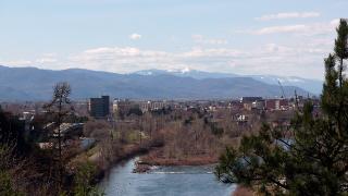
Between about 15,000 and 13,000 years ago a lobe of ice blocked the Clark Fork River near today's Idaho line, and the water backed up into Glacial Lake Missoula: about 2,900 square miles and more than 500 cubic miles of water, about 950 ft deep over present-day Missoula. Each time the ice dam failed, the lake emptied west across Idaho and Washington in a few days. Estimates put the number of floods at around 40 over 2,000 years or more.
- Old shorelines: faint horizontal lines on Mount Sentinel and Mount Jumbo above Missoula, clearest with a dusting of snow. The M Trail climbs through them.
- Giant ripples: at Camas Prairie, about 12 miles north of Perma, ridges 15 to 50 ft high and up to half a mile long are a National Natural Landmark. The land is not open to the public, so look from the public road.
The Yellowstone hotspot and the 1959 earthquake
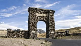
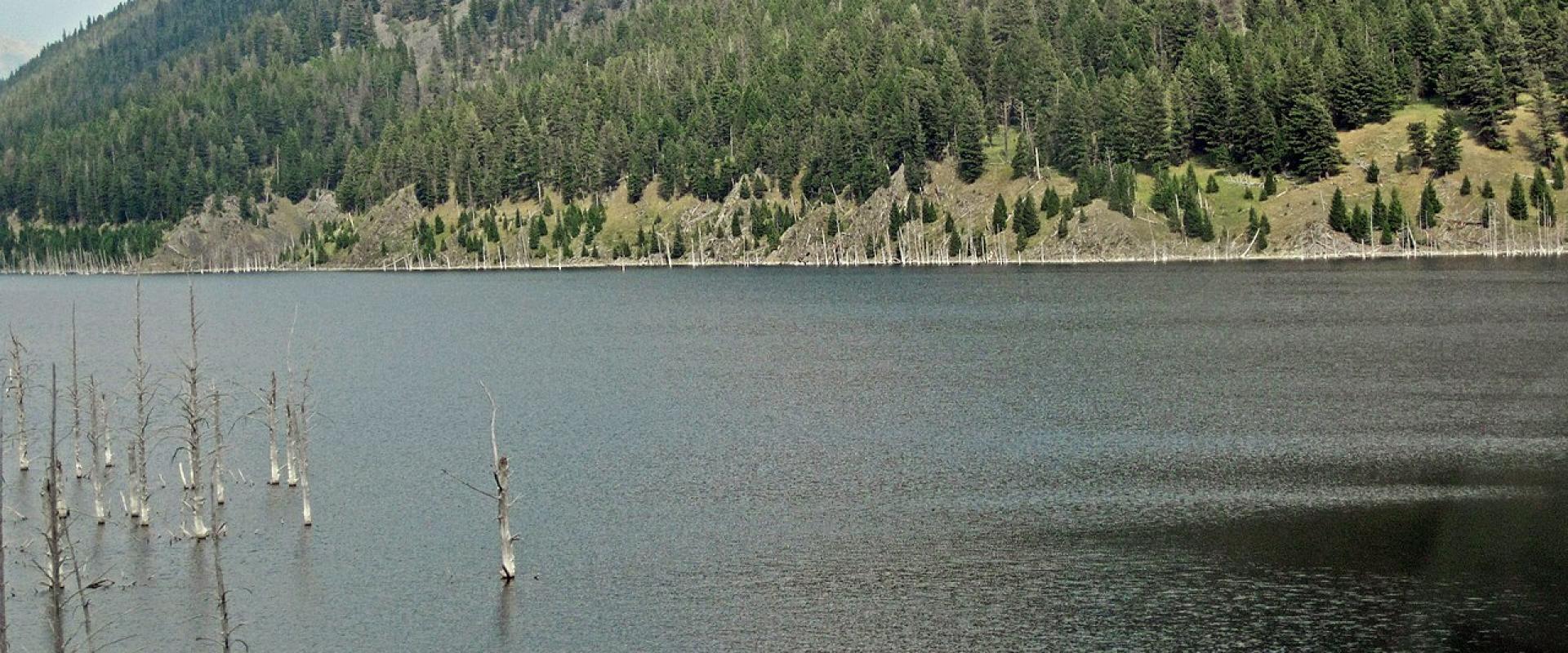
Only about 3% of Yellowstone is in Montana, and the caldera and nearly all the geysers are in Wyoming. Montana gets the hotspot's shaking. At 11:37 p.m. on August 17, 1959, a magnitude 7.2 earthquake struck near Hebgen Lake, about 15 miles north of West Yellowstone. A mountainside of about 80 million tons fell into the Madison River canyon, burying a campground, and 28 people died. The slide dammed the river and created Earthquake Lake. The Earthquake Lake Visitor Center, on top of the slide, is open from the Friday of Memorial Day weekend to September 15.
Missouri Breaks and the eastern badlands
East of the mountains the Missouri River has cut the plains into the Missouri Breaks: white sandstone cliffs, eroded spires and dry coulees. The Upper Missouri River Breaks National Monument (BLM), proclaimed in 2001, protects about 377,000 acres, and a 149-mile stretch of the river has been Wild and Scenic since 1976. The Missouri Breaks Interpretive Center in Fort Benton has a scale model of the whole corridor. The classic way in is a multi-day canoe float past the White Cliffs; see our water activities guide. Downstream, the breaks frame Fort Peck Lake inside the Charles M. Russell National Wildlife Refuge.
Other places to see the plains' bones:
- Makoshika State Park near Glendive, Montana's largest state park at more than 11,000 acres of badlands.
- Giant Springs in Great Falls, where water that fell as snow in the Little Belt Mountains comes up at a constant 54 °F after about 3,000 years underground.
- Lewis & Clark Caverns, a limestone cave system west of Bozeman, toured May to September.
Dinosaur beds: Hell Creek and Egg Mountain
Montana's fossil country is some of the richest in the world, because Cretaceous mud and sand here were never buried too deep to reach.
- Hell Creek Formation: named for Hell Creek near Jordan in Garfield County, it holds some of the last dinosaurs before the extinction 66 million years ago. The first Tyrannosaurus rex known to science was dug from it near Jordan starting in 1902. The Garfield County Museum in Jordan shows a T. rex skull and a Triceratops cast, and the Fort Peck Interpretive Center has a life-size model of Peck's Rex.
- Egg Mountain: west of Choteau, in the older Two Medicine Formation. Fossil bones found here in 1978 led Jack Horner and Bob Makela to name Maiasaura, the "good mother lizard", in 1979, now Montana's state fossil. The site is not open for casual visits; ask the Old Trail Museum in Choteau or the Montana Dinosaur Center in Bynum about guided trips.
- Montana Dinosaur Trail: 15 museums and sites from Bynum to Ekalaka, with a passport to stamp along the way. The biggest collection is at the Museum of the Rockies in Bozeman. Our family activities guide covers it with children.
Before you go
- Check Glacier's road and trail status before planning Logan Pass, Grinnell or Cut Bank.
- Visit the Earthquake Lake Visitor Center between late May and mid-September.
- Book Lewis & Clark Caverns tours ahead in summer.
- Carry water and fuel for the Breaks and eastern badlands; services are far apart.
- Don't collect fossils on public land; leave finds in place and report them.
Details checked October 2026.