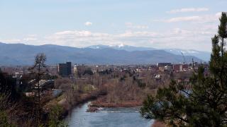
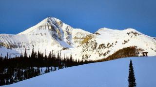
Montana is the fourth-largest state, with about 1.1 million people, and the phone networks follow the people. Coverage is good in and around Billings, Missoula, Bozeman, Kalispell and Great Falls and along most of the interstates. Away from those, signal can disappear for an hour or more of driving, and in Glacier and Yellowstone it is limited to a handful of developed areas.
Plan as if you will lose signal: download maps, tell someone your route and know your options for an emergency. This guide covers where the big gaps are, how to check road conditions through 511, what satellite features on phones can and can't do, and what Wi-Fi to expect in the national parks.
Where the gaps are
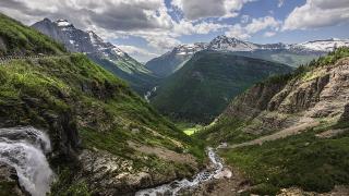
Glacier National Park
The park says connectivity is "very limited". Reception is best from West Glacier up to Apgar Village, and limited at St. Mary. Visitors should expect no reception at:
- Logan Pass
- Many Glacier
- Two Medicine
- The North Fork and Goat Haunt
- The backcountry
- US-2 along the park's southern edge
A 2022 park telecommunications plan allows commercial service to be added at four developed areas (Lake McDonald Lodge, Many Glacier, Rising Sun and Two Medicine) but rules it out in the backcountry. We could not confirm what has been built, so don't count on it.
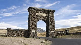
Yellowstone National Park
Yellowstone describes cellular service as "extremely limited" and says texting is usually the most reliable way to communicate. Signal is most likely around developed areas such as Mammoth, Old Faithful and the gateway towns, including Gardiner and West Yellowstone. In summer crowds can overload what network there is. The Lamar Valley and long stretches between junctions often have none.
The Beartooth Highway
Carbon County's sheriff notes limited cell service for calls along the Beartooth Highway, and campers report no service from the major carriers at places like Beartooth Lake. There is an emergency call box at Vista Point, about 19 miles south of Red Lodge. The highway closed for the 2026 season on October 9 and should reopen around late May 2027.
The Hi-Line and eastern Montana
US-2 across the north links small towns that are far apart by road, and coverage between them is patchy. Approximate driving distances from the OSRM router:
| Stretch of US-2 | Distance |
|---|---|
| Shelby to Havre | about 103 miles |
| Havre to Malta | about 89 miles |
| Malta to Glasgow | about 70 miles |
| Glasgow to Wolf Point | about 49 miles |
The same goes for the back roads of the Charles M. Russell National Wildlife Refuge, the Missouri Breaks and the southeast badlands. Check your carrier's own coverage map before relying on it.
Offline maps and planning
- Download maps for the whole area you will drive or hike. Google Maps and Apple Maps both let you save areas offline, and dedicated hiking apps can store topographic maps.
- The NPS App lets you download park content, including maps, for offline use. Do it on Wi-Fi before you arrive.
- Carry a paper map, especially for national forest roads, which offline navigation apps sometimes route along unmaintained tracks.
- Fill up before remote stretches: services are few between Red Lodge and Cooke City, and on parts of the Hi-Line.
- Screenshot key information: permits, Recreation.gov shuttle tickets, hotel confirmations and trail status pages.
Montana 511 for road conditions
The Montana Department of Transportation runs the state's 511 service:
- Phone: dial 511 inside Montana, or 800-226-7623 from elsewhere.
- Web: 511mt.net, with conditions, closures and road cameras.
- App: search "MDT 511".
511 covers interstates, US routes, state highways and some secondary roads, but not county roads or city streets. Condition reports are not live: maintenance staff update them at least twice a day on weekdays and rarely on weekends, so check the "conditions as of" time on each segment. Road weather cameras refresh about every 15 minutes in winter. For roads inside the parks, use the NPS road status pages; Yellowstone also has recorded road information at 307-344-2117.
Satellite messaging and phone SOS
New phones can reach help where there is no cell signal, but only outdoors with a clear view of the sky.
- iPhone 14 and later: Emergency SOS via satellite works in the US. If a 911 call fails, the phone guides you to text emergency services and can share your location, elevation and Medical ID. Apple says it is free for two years after activation; check current terms.
- Android: several recent models, including the Pixel 9 series, offer satellite SOS or satellite texting, depending on the phone and carrier.
- T-Mobile T-Satellite: satellite texting through Starlink on supported phones; in late 2025 T-Mobile opened satellite text to 911 to compatible phones on other carriers too. Check your model on T-Mobile's supported-device list.
- Dedicated devices: satellite messengers and personal locator beacons (PLBs) work regardless of your phone and carrier, and are the safer choice for backpacking or remote driving.
Satellite connections take time and fail under thick forest or in narrow canyons. Test the demo mode at home before your trip.
Text and 911
Many Montana 911 centers accept text to 911 when a voice call won't connect, including Carbon County on the Beartooths. If text isn't available, you'll get an automatic bounce-back message. A text often gets through where a call won't, but call when you can.
Wi-Fi in the parks
Don't plan to work from inside the parks.
- Glacier: "There is little WiFi connectivity." Public Wi-Fi is offered at the Apgar and St. Mary visitor centers. St. Mary is seasonal, and Apgar Visitor Center is open daily from mid-May to mid-October and only on weekends in winter.
- Yellowstone: free public Wi-Fi at the Albright Visitor Center in Mammoth, the Old Faithful Visitor Education Center and the West Yellowstone Visitor Information Center. Some lodges offer Wi-Fi to registered guests.
- Gateway towns: hotels and cafes in Whitefish, West Glacier, Gardiner and West Yellowstone usually have Wi-Fi, though speeds vary.
Before you go
- Download offline maps and the NPS App content on Wi-Fi.
- Save 511mt.net and the park road status pages.
- Check whether your phone supports satellite SOS, and try the demo.
- Consider a satellite messenger or PLB for backcountry trips.
- Leave your route and return time with someone.
- Fill your tank before the Beartooths, the Hi-Line and refuge roads.
Details checked October 2026.